Object Detection
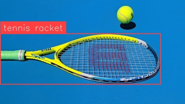
Tennis Racket Detection
Locate, label and count tennis rackets in an image.
Locate, label and count potholes in an image.
Use This Free TemplateTry Preview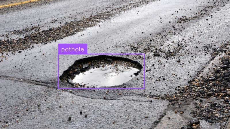
Instantly map and quantify road damage by detecting individual potholes in street-level imagery, giving maintenance crews precise location data for targeted repairs.
Try it now:
Roads deteriorate silently until that jarring moment when vehicles hit unexpected potholes, leading to costly repairs and frustrated drivers. Municipal teams traditionally rely on manual surveys or citizen complaints to track road damage - a reactive approach that leaves dangerous road hazards unaddressed for weeks. This pothole detection template transforms routine street photography into actionable maintenance data, enabling crews to proactively identify, prioritize, and repair road damage before it impacts public safety or triggers vehicle damage claims.
Every detected pothole translates directly into maintenance cost savings and improved public safety. By automatically processing street-level imagery, this template eliminates the need for dedicated inspection teams while dramatically accelerating the identification of road hazards. Maintenance crews receive precise coordinates and damage assessments, allowing them to optimize repair routes and allocate resources based on severity. The result? Faster repairs, reduced vehicle damage claims, and street networks that stay safer year-round through data-driven maintenance.